Chuluut River Valley
Chuluut River Valley
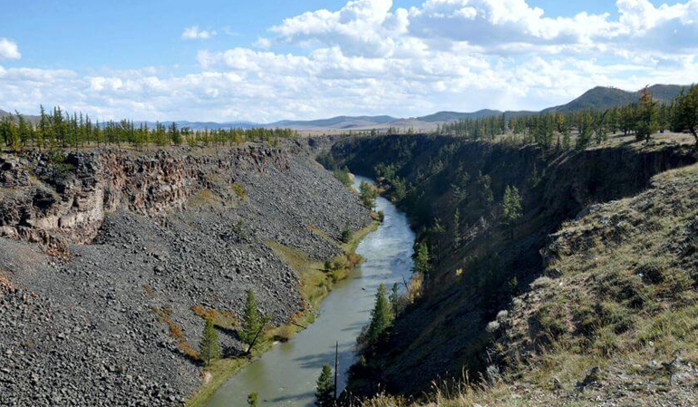
Chuluut River starts from Eg mountain pass, which is of the Gurvan Angarkhai Mountain in the eastern part of Khangai Mountain range. It flows for 415km joining Ider River and becomes a tributary of Selenge River, which is the biggest river of Mongolia and reaches to the Baikal Lake. Due to its basin with numerous rocks and boulders, the river is called Chuluur River. This means ‘Rocky river’ in Mongolian. The river flows between a long and deep canyon for about 100km. The canyon depth is up to 60m (at some point over 60m) and composed of trap rocks. The rocks are dark-colored, fine-grained, non-granitic intrusive or extrusive igneous rock.
It is said that these igneous rocks were result of the volcanic organs came from Khorgo volcano when it erupted during Holocene. Some experts say that the Khorgo volcano erupted twice. As a result the terraces of Chuluut canyon shows different ages of sediments related to Pleistocene age and Holocene age. On the valley of Chuluut River colluvial sediments of Quaternary period are scattered around here and there. The dark-brown or humid dark-brown soils are common.