Khyargas lake
Khyargas lake
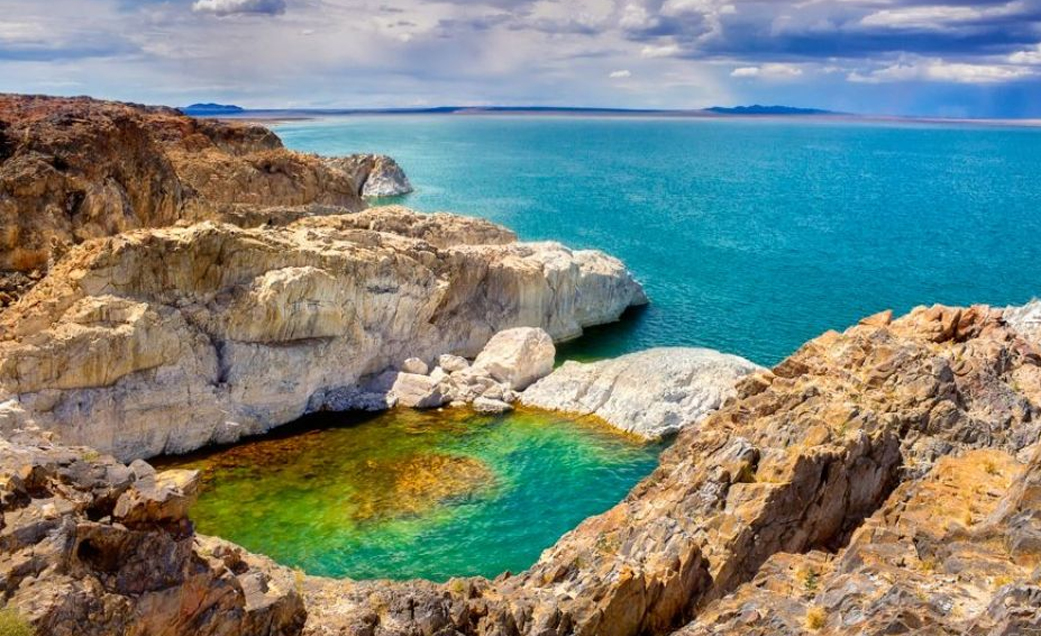
In the Great Lakes Depression, within the territories of Zavkhan, Naranbulag, Tsagaanhairkhan, Malchin, and Khyargas soums of Uvs province, and on the southern side of the Khankhukhii Range, lies Lake Khyargas. The lake covers a surface area of 1,407 square kilometers, with a length of 75 kilometers, a width of 31 kilometers at its widest, and an average width of 19 kilometers. Its water surface is 1,028 meters above sea level. Since Lake Khyargas is situated in a tectonic depression, its shoreline is highly irregular. Consequently, several narrow peninsulas extend into the lake, the largest being the Nuuriin Peninsula at 7 kilometers, followed by the Chaatsargana Peninsula at 4 kilometers, and the Mogoin Peninsula at 5 kilometers.
On the northern shore of the lake, there is a health resort called Khar Termes Mineral Springs. It features mineral waters that are used to treat internal diseases, and its mud is also used for therapeutic purposes.
Khetsuu Khad: Located 230 kilometers southeast of the provincial center and 60 kilometers from Zavkhan soum, on the eastern part of Lake Khyargas, there is a 20-meter high rocky cliff that extends 5-7 kilometers underwater, known as Khetsuu Khad. Some peaks of this cliff protrude from the water, appearing as impressive islands. These protruding peaks are a paradise for water birds, where they nest and lay eggs. Lake Khyargas is abundant with Altai osman, osman fish, Mongolian grayling, pike, and yellow fish, which are the primary food source for the birds nesting on Khetsuu Khad.