Eastern Mongolia
Eastern Mongolia
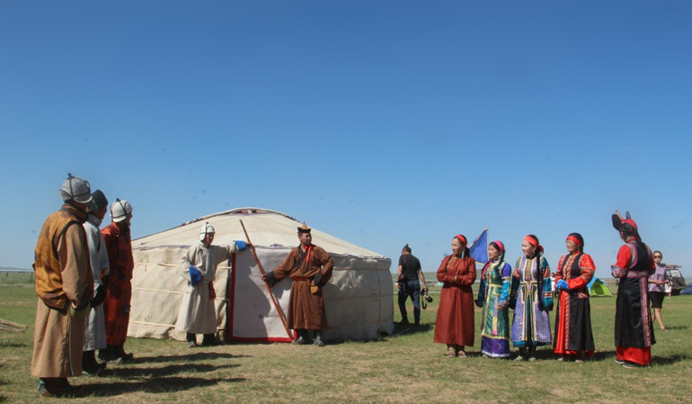
The eastern part of Mongolia is a region known for its vast steppes, high mountains. Mysterious travel destination in eastern Mongolia is the Birthplace of Great Chinggis Khaan who united all Mongolia in the XIII century. The land of well-respected high mountains taiga forests, wide open steppe-grassland, many rivers, lakes, all places written in world history of XIII century. A tour in Chinggis Khaan`s birthplace in the eastern part of Mongolia offers a deep dive into the history and legacy of one of the world's most influential figures.
Dariganga tribe
In the late 17th century, the settlement of three different ethnic groups—Khalkha, Chahar, and Oirat—in the eastern part of Mongolia, specifically in the Dariganga region, led to their merging and the formation of an entirely new ethnic group-Dariganga.
Read More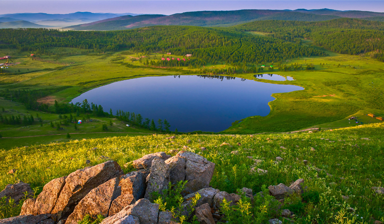
Khukh lake /Blue lake/ - Black Heart mountain
To the northwest of the center of Tsenkhermandal soum in Khentii province, near the Tsenkher River, lies Khukh Nuur of Black Heart. Blue Lake consists of two interconnected freshwater lakes located at an altitude of 1675 meters above sea level in the Valley of Khar Zurkh Mountain.
Read More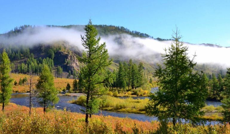
Khan Khentii strictly protected area
The Khan Khentii strictly protected area is a 12,270 km2 government administered Strictly Protected Area in the Khentii province in Eastern Mongolia. Strictly protected areas are regions of land designated by the Mongolian government as preservation areas.
Read More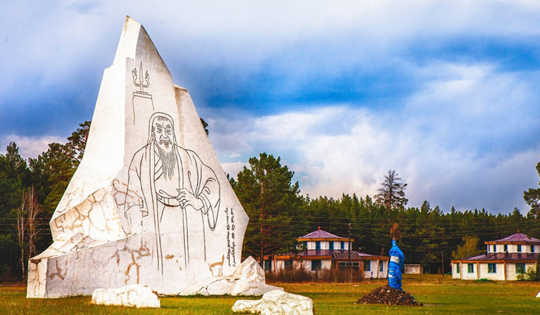
Deluun Boldog Dadal Soum (Believed to be birthplace of Chinggis Khaan)
Temuujin was born into the family of Esukhei hero in 1162 at a place called Deluun Boldog by the Onon River in Dadal soum in Khentii province. Beginning from 1185, Temuujin directed a military campaign to unite the Mongolian tribes, which was at that time divided into more than 80 feuding ethnic clans. Finally in 1206 The Great Mongol Empire was established and Temuujin was declared Chinggis Khaan which meant “Great Khaan”.
Read More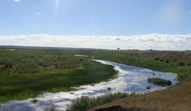
Khalkh Numrug River Basin
The catchment area of the Khalkh and Numrug rivers, where a small part of the Khyangan Range extends westward to merge with the Mongolian Great Steppe, is a region of exceptional natural beauty.
Read More
Buir Lake
Buir Lake, located 65 km northwest of the center of Khalkhgol soum in Dornod Province, is the lake with the most fish species in our country. It stretches 40 kilometers from northeast to southwest, with a width of 21 kilometers, covering an area of 615 square kilometers, making it the fifth largest lake in Mongolia. The average depth of the lake is 6 meters, reaching up to 16 meters at its deepest point. Buir Lake is situated at an elevation of 583 meters above sea level.
Read More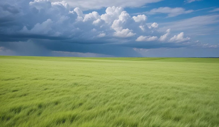
Menen steppe - Eastern Mongolian Grassland
The Menen Steppe, located in the vast expanse of Eastern Mongolia, is the largest plain in our country.
Read More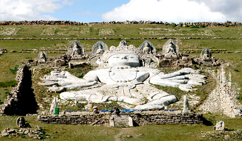
Ikh Burhant
Ikh Burkhant," one of Mongolia's significant historical and cultural monuments, is located 35 km north of Sumber, the center of Khalkhgol sum in Dornod Province, on a 35-degree sloping bank on the right side of the Khalkh River. This monument, created by Khalkh nobleman Bat-Ochiryn Togtokhtör (To prince) (1797-1868), is famously known as "Ikh Shuteen" or "Ikh Burkhant."
Read More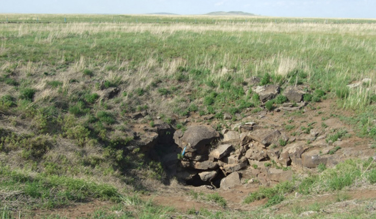
Taliin Agui-step Cave
Taliin Cave is located in Dariganga sum, Sukhbaatar Province, 13 km north of Shiliin Bogd Mountain, situated in a flat plain.
Read More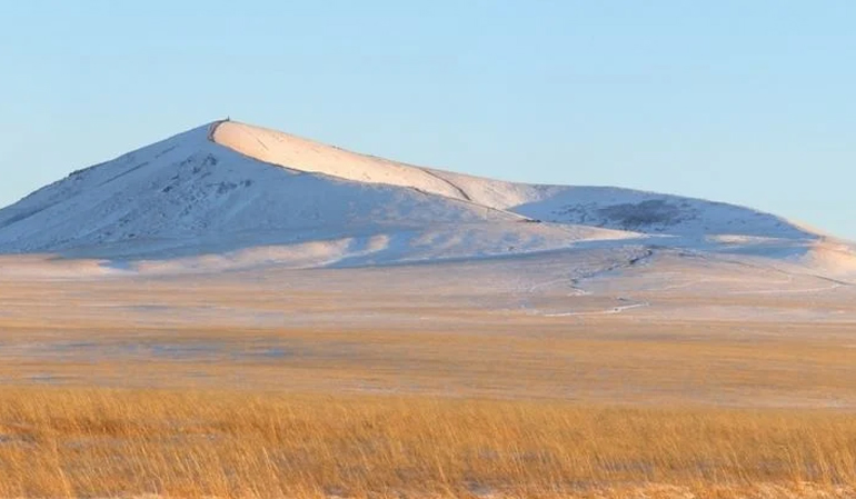
Shiliin Bogd Volcano
Sixty kilometers southeast of Dariganga soum, at an elevation of 1778 meters above sea level, lies Shiliin Bogd, the highest of about 200 extinct volcanoes in this elevated plain. The crater of Shiliin Bogd Mountain has broken open towards the northwest, with a rim approximately two kilometers wide and about 300 meters deep.
Read More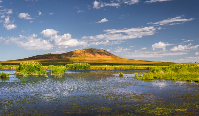
Altan Ovoo Dariganga
Alten Ovoo, also known as Dari Ovoo, is located in Dariganga soum, in Sukhbaatar Province, on the northern edge of Moltsog Sands. This extinct volcano rises to an elevation of 1354 meters above sea level and is situated 180 km from Baruun-Urt city. Alten Ovoo is a state-worshipped mountain.
Read More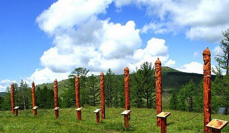
Kherlen's Khuduu Aral
A steppe with size of 600 km2 in the Kherlen Bay is located in the south of Kherlenbayan Ulaan Mountain. The Conqueror Chinggis Khaan Great Aurag Mansion was on the bank of Avarga River of this steppe.
Read More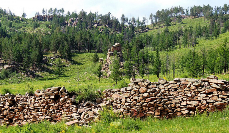
Uglugch Wall
There are stones walls that are built punctiliously without using clay in the mouth of Daichin Mountain, covered with pine and larch forests and located in the confluence of Bayan and Oglogch rivers, which are in the west of Batshireet Soum center. These walls are called Oglogch Kherem.
Read More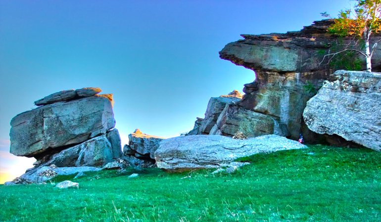
Rashaan Khad
Rashaan Khad is located in the territory of Batshireet sum in Khentii province, at the rocky tip of the southeastern foothills of Binder Mountain. Rashaan Khad is a historical and cultural complex in eastern Mongolia that dates from the Stone Age to the 16th century.
Read More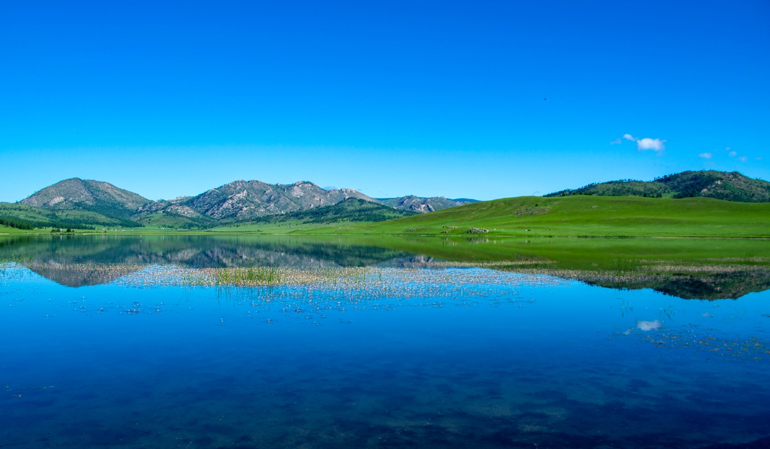
Khangal Lake
The lake is located in the Ömnödölgör sum of Khentii province. It lies in the southeastern part of the Khentii mountain range, between the Khurkh River and its tributary, the Jargalant River. In 2012, it was designated as a 'Natural Monument' and placed under state special protection.
Read More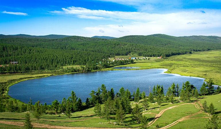
Khar Zurkh (black heart) Khukh Nuur (blue lake)
Khar Zurkh Khukh Nuur is located 35 kilometers north of the central road in the eastern region, northwest of the center of Tsenghermandal sum in Khentii province, near the Tsengher River. Khukh Nuur consists of two interconnected freshwater lakes situated in the hollow of Khar Zurkh Mountain at an altitude of 1675 meters above sea level.
Read More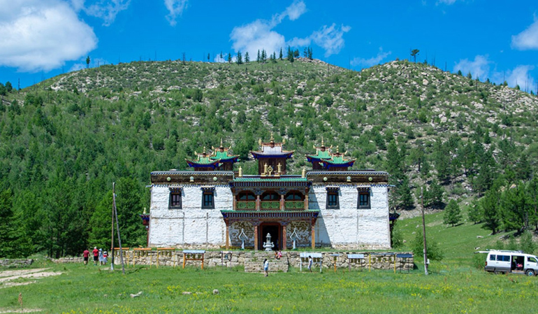
Baldan Bereeven Monastery
Baldan Bereeven Monastery, located in the territory of Omnodelger sum in Khentii Province, was established in 1777 in the beautiful wilderness of the northern side of the Mönkh-Ölzii Mountain and the northern part of the Bat River.
Read More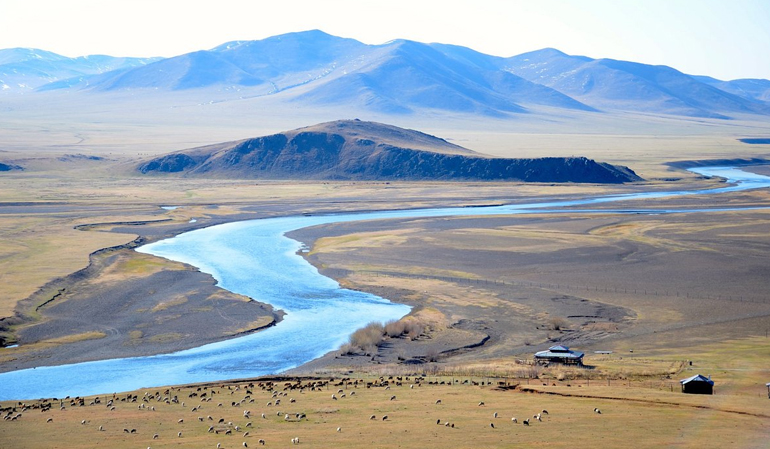
Gun Galuut nature reserve
In Bayandelger soum of Töv Province, there are two lakes called Ikh Gun and Baga Gun. South of these lakes, the Ayagiin River flows southeast and joins the Kherlen River. The northern slope of the river is called Ayaga Mountain, and in one of its valleys, D. Natsagdorj, the founder of modern Mongolian literature, was born.
Read More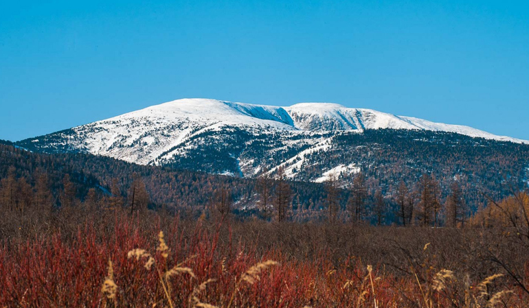
Burkhan Khaldun Mountai
Burkhan Khaldun Mountain is considered to be the birthplace of Chinggis Khaan, as well as one of the rumored locations of his tomb.
Read More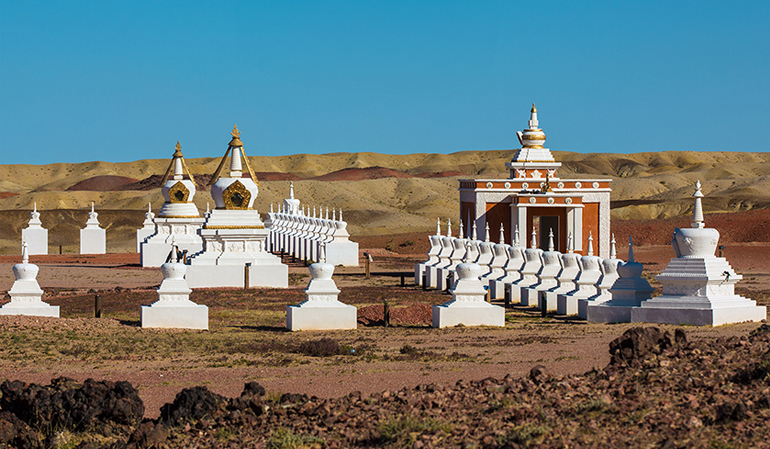
Khamariin Khiid Monastery
Sainshand, center of Dornogovi Province, is home to numerous natural and historical attractions that captivate both foreign and domestic tourists.
Read More